North Romang Project
Wyaru
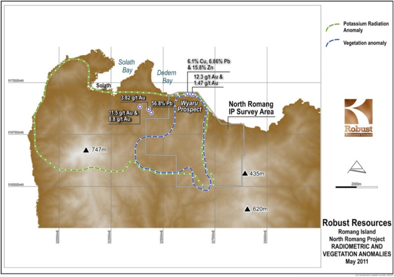
The accompanying figure shows the co-incident radiometric and vegetation anomalies that extend southwards from the west to the central northern coastline on Romang, centred on the Wyaru Prospect area. The vegetation anomaly consists of open to stunted eucalypt forest and it is closely related to areas of strong hydrothermal alteration and leached soils. The extensive potassium radiometric anomaly maps out a large system of hydrothermal alteration and intrusive rocks.
During 2011 Robust completed a first phase, 167 line kilometre, 3D Induced Polarization (IP) survey at the North Romang Project. Significant IP anomalies have now been modelled in areas that have coincident soil geochemical and aeromagnetic anomalies. Along with prospective surface geology, the data all supports the model for a large-scale porphyry-style target.
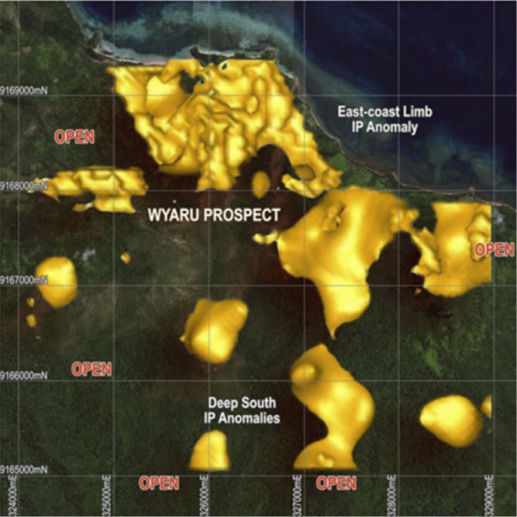
The major IP anomalies are located within the Wyaru Prospect Grid area of the North Romang Project, occur over a substantial proportion of the gridded area and have a N-S strike of 4.5 kilometres and are open to the south. The anomalies extend in depth to the limit of detection of the IP method, which is greater than 500 vertical metres, i.e. the anomalies are mostly open and strengthening at depth. These anomalies can be clearly seen in the image titled "Romang North IP Anomalies".
These anomalies are in areas where Robust has previously described the prospective outcrops of altered and mineralised volcanic and intrusive rocks which outcrop along the north coast of Romang Island discovered in 2010 when Robust undertook an extensive program of gridding, geological mapping, soil sampling and geophysics.
The mapping identified a large package of highly altered, strongly leached, andesitic volcanic and quartz diorites along with multi-element soil geochemical anomalies. This altered and mineralised rock package corresponds well with the previously described radiometric anomaly and vegetation anomaly (Figure 7).
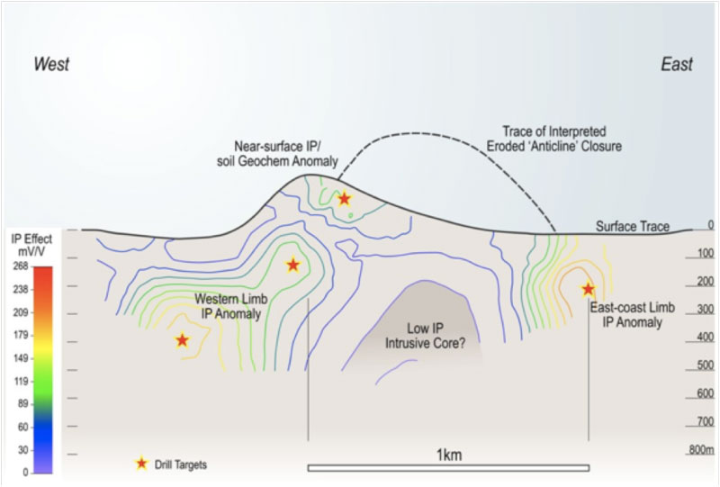
The internal structure of the IP anomalies is interpreted as being an "anticlinal" structure, which fits well with the porphyry intrusive model for the mineralisation.
The large-scale IP anomalies further enhanced the prospectivity of the North Romang project and were the key factor that determined the design of a 5,000-metre exploration diamond drilling programme. As the company is currently focussed on resource definition drilling at Lakuwahi implementation of this drilling will be deferred to 2013. In the meantime, we invite you to subscribe to our Email Alerts to be notified of important company information as it is released.