Indonesia
North Romang Project
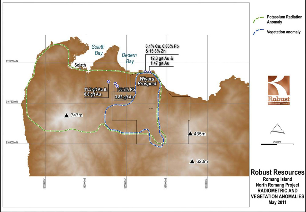
The figure to the right shows the co-incident radiometric and vegetation anomalies that extend southwards from the west to central northern coastline on Romang, centered around the Wyaru Prospect area. The vegetation anomaly consists of open to stunted eucalypt forest and it is closely related to areas of strong hydrothermal alteration and leached soils. The extensive potassium radiometric anomaly maps out a large system of hydrothermal alteration and intrusive rocks.
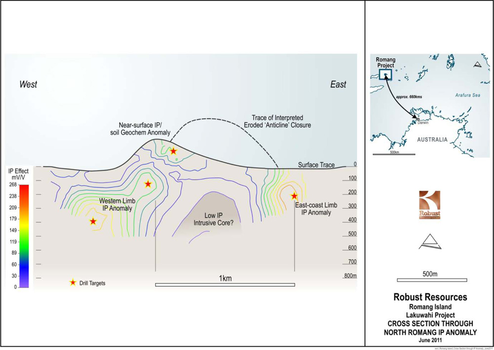
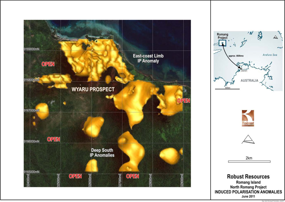
Significant IP anomalies have been modelled in areas that have coincident soil geochemical and aeromagnetic anomalies. Along with prospective surface geology, the data all supports the model for a large-scale intrusive-related target.The major IP anomalies are located within the Wyaru Prospect of the North Romang Project. They occur over a substantial proportion of the gridded area (Figure below), have a north-south strike of 4.5 kilometres and are open to the south. The anomalies extend in depth to the limit of detection of the IP method, which is greater than 500 vertical metres, i.e. the anomalies are mostly open and strengthening at depth.
It is the company's strategy to focus initially on commercial outcomes from the more advanced Lakuwahi project before embarking on large-scale deep drilling at North Romang. Drilling is expected to commence in late 2014.